Last weekend I hit the trails near Escondido in north San Diego. I hiked the 6+ mile Mule Hill Trail which is part of the San Dieguito River Park, starting from the parking lot near Sikes Adobe Historic Farmstead and heading in an easterly direction. I have mountain biked this route many times, going all the way past the fruit trees at the bottom of highway 78. Normally that takes in about 25 miles of scenery, but on foot I like to keep my hikes somewhere between 6 and 8 miles. With lots of photos taken along the way I can knock these out in 2 – 2.5 hours.
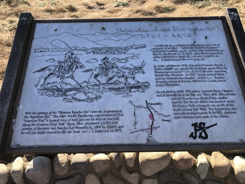
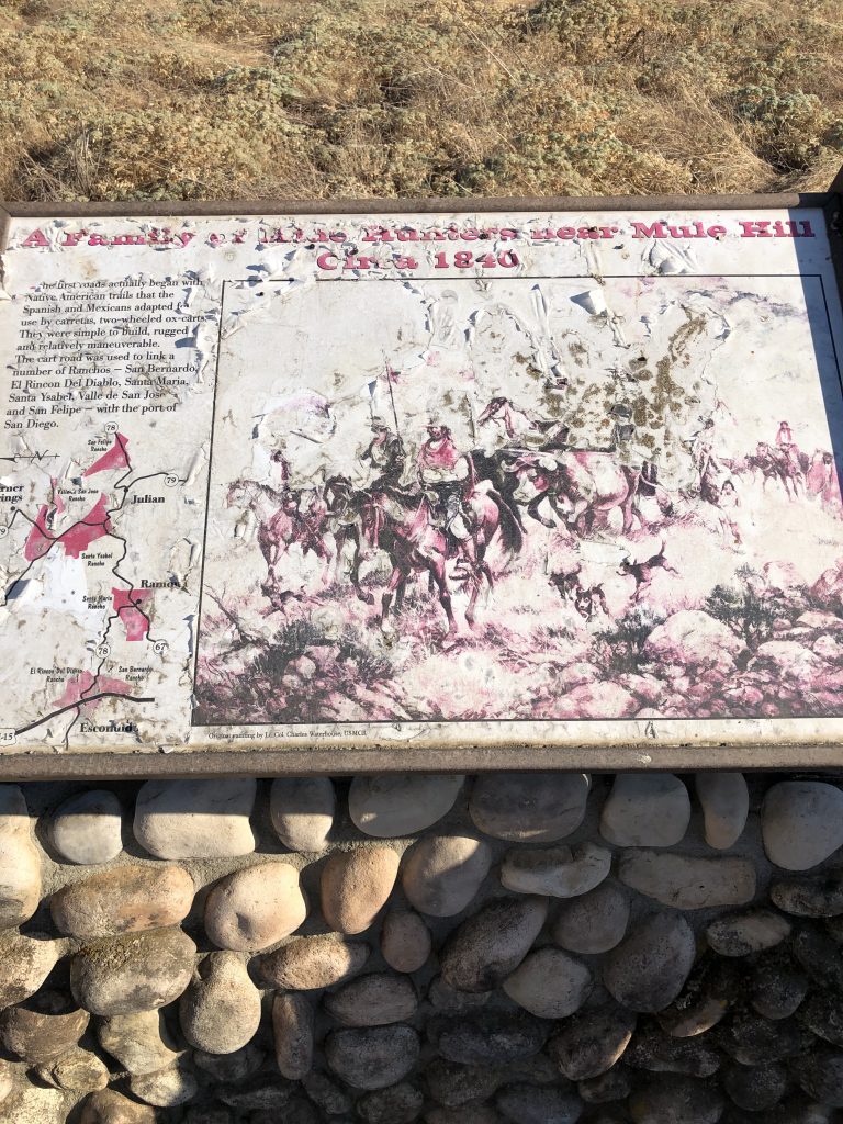
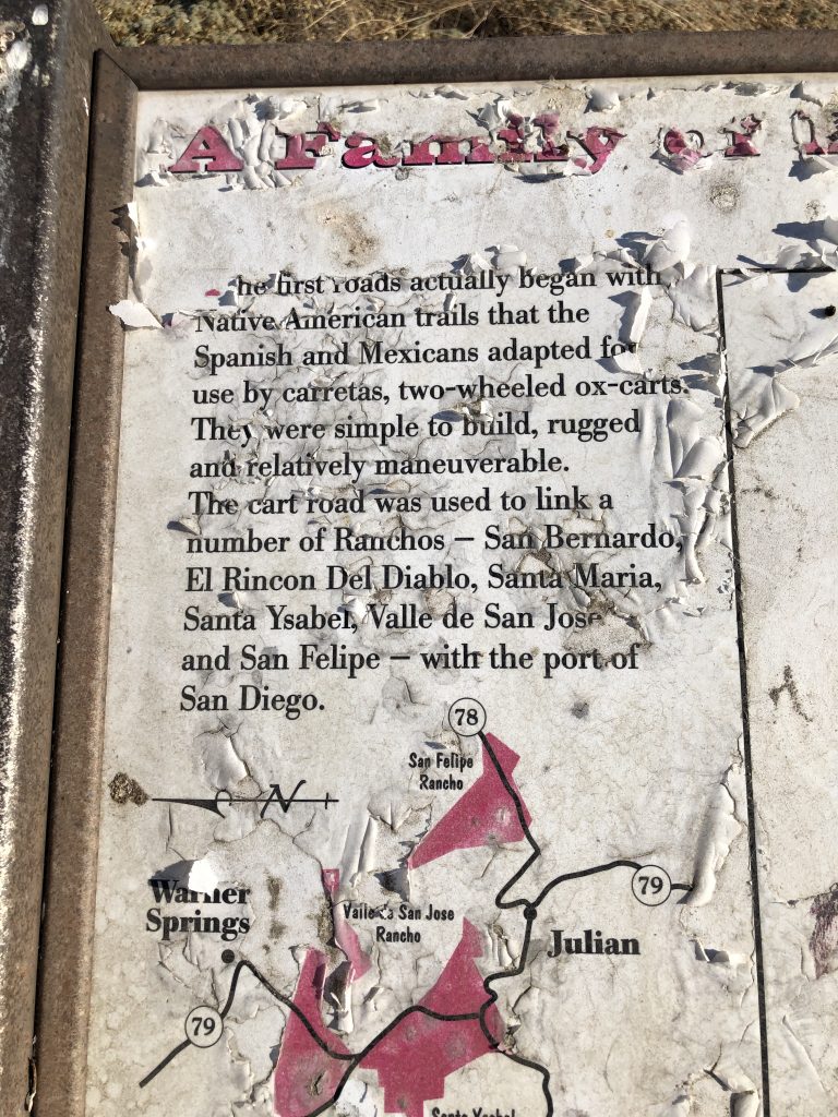
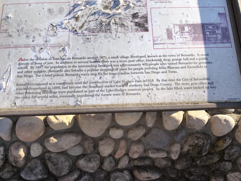
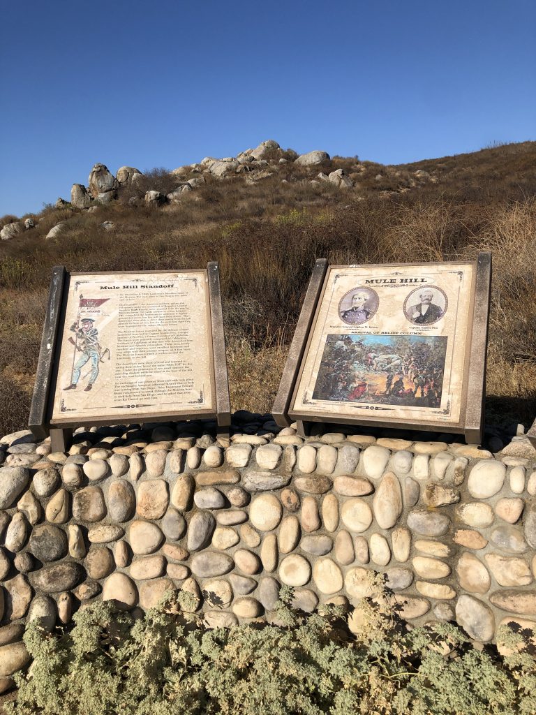
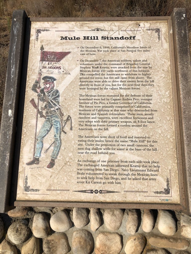
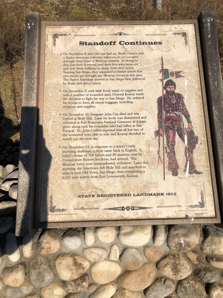
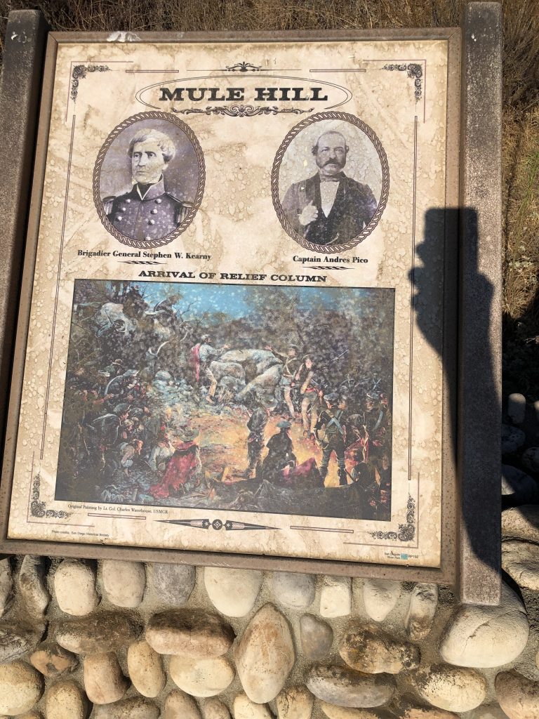
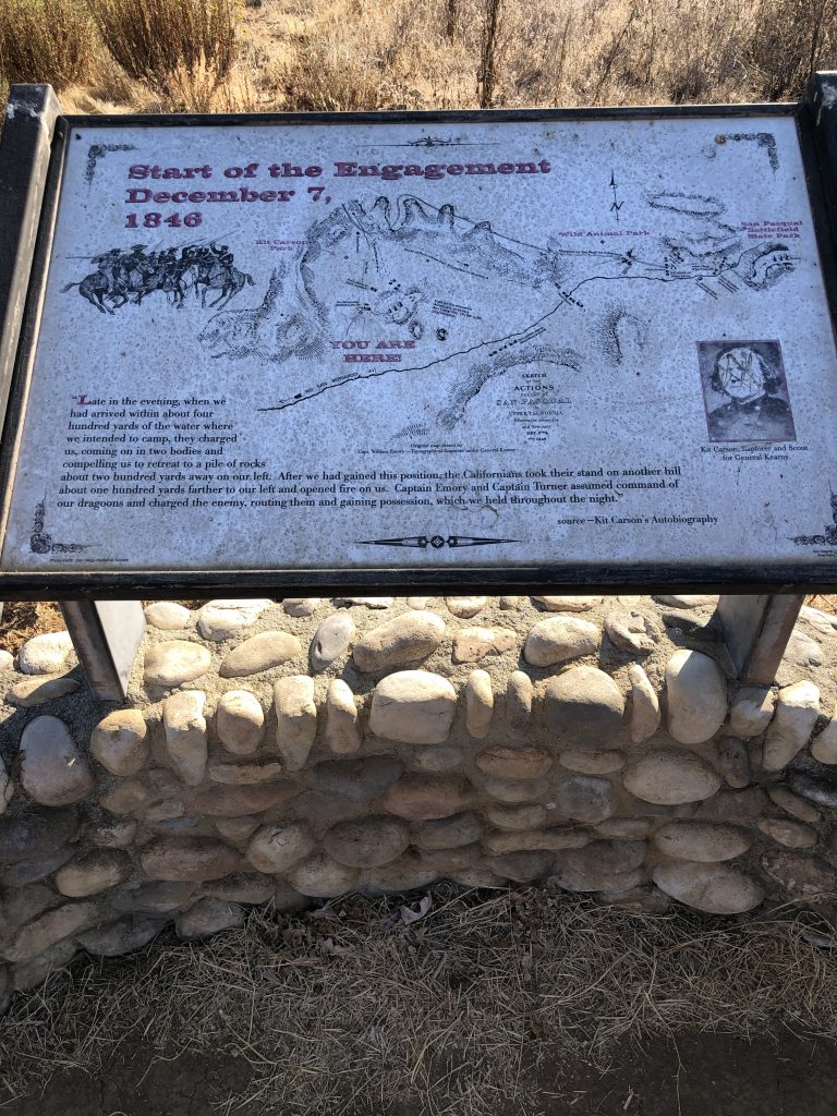
Near the start of this particular route, approx 1 mile along, there are extremely interesting interpretive boards documenting the area’s past, most notable the battle that happened right here, way back in December 1846 between American and Mexican forces. It’s a fascinating story, and for those of you unable to make your way out here, I took some pictures so you can read about the events from that time. Additionally, I have included some photos of the boards that document some of the advances in area development as we move in to the late 1800’s and early 1900’s.
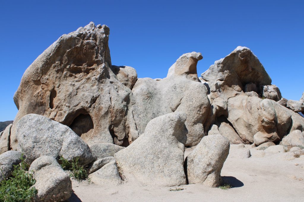
It’s a beautiful part of San Diego county. Get out there and enjoy it for yourself if you can!
I saw a small pack of coyotes a little further along the trail! Check ’em out!